

Now, back to Maine, for a look at the tidal power history of the Basin, past and present.
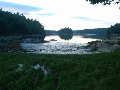
The Basin is a nearly-completely enclosed bay in the town of Phippsburg, Maine. On a satellite photo map, you can see how the tide would ascend the New Meadows River (here, effectively a bay in the ocean) and then enter the narrow gates of the Basin between Brightwater and the Denny Reed Point area.
Last night I checked out the remains of a tide mill site at the upper end of the southeastern arm of the Basin. You can see where a stone structure was built across the mouth of the tidal flat. Last night, on a dropping tide, the water was flowing down over the stone structure, keeping a bed of mussels very happy.
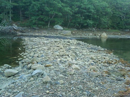
I have found one source that says there were once two tide mills at this location. Other than the stone structure and evidence of old roads in the area, I didn't see much else in the way of obvious archeological clues. The mill pond is still relatively deep on the west side, and I did see small fish swimming around above the rock ramp. Black-backed and herring gulls were dropping shellfish onto the ledges to crack their shells, and several osprey passed overhead carrying their cleaned catches back to their nests.
Today, the Basin is protected by The Nature Conservancy. An anonymous donor left nearly 2,000 acres to TNC. Clam diggers still bring in a substantial harvest from the upper Basin (including the tide flats above the rock structure in the picture above), and it is a popular site for hiking, biking, and hunting.
No comments:
Post a Comment